


![]()


![]()


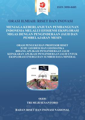
Di tengah transisi energi global menuju Net Zero Emission (NZE) 2060, minyak dan gas bumi (migas) diproyeksikan masih memegang peranan vital sebagai penopang utama ketahanan energi nasional hingga tahun 2050. Tantangan untuk mencapai target produksi 1 juta barel minyak per hari (BOPD) pada tahun 2030 menuntut adanya transformasi strategi eksplorasi yang lebih efektif, efisien, dan presisi.
Naskah orasi ilmiah ini mengelaborasi terobosan pemanfaatan teknologi penginderaan jauh (remote sensing) yang diintegrasikan dengan pembelajaran mesin (machine learning) untuk menjawab tantangan tersebut. Lebih lanjut, orasi ini memaparkan evolusi metode eksplorasi, mulai dari pemetaan geologi konvensional hingga penerapan algoritma Random Forest dan analisis anomali permukaan berbasis data multisumber. Pendekatan integratif ini terbukti mampu mendeteksi area prospek migas baru—termasuk di Cekungan Sumatera Tengah dan Pulau Jawa—serta mengidentifikasi potensi formasi saline untuk penyimpanan karbon (carbon capture and storage).
Melalui analisis mendalam mengenai anomali geobiokimia, cekaman vegetasi, dan alterasi mineral, karya ini menawarkan solusi konkret untuk meningkatkan faktor peluang geologi (Geological Chance Factor) sekaligus menurunkan risiko dan biaya eksplorasi secara signifikan. Orasi ini merupakan referensi esensial bagi akademisi, praktisi industri energi, dan pembuat kebijakan dalam merumuskan strategi pengelolaan sumber daya alam yang mendukung keberlanjutan pembangunan Indonesia.
Abdoli, N., Alipour, M., & Pasokhi, M. (2024). Mapping Energy Expansion: Remote Sensing Insights into Oil and Gas Infrastructure and Land Use Changes in Midland, TX. Journal of Geoscience and Environment Protection, 12(07), 89–108. https://doi.org/10.4236/gep.2024.127006
Arellano, P., Tansey, K., Balzter, H., & Boyd, D. S. (2015). Detecting the effects of hydrocarbon pollution in the Amazon forest using hyperspectral satellite images. Environmental Pollution, 205, 225–239. https://doi.org/10.1016/j.envpol.2015.05.041
Ariadji, F. N., Wikantika, K., & Ariadji, T. (2017). Analisis hasil metode potensi minyak bumi dengan teknologi STeP (Sub-Terrain Prospecting) (studi kasus blok Lampung). In Bunga Rampai ForMIND 2017 (1 ed., hal. 51–67). ITB Press.
Attwa, M., Elkafrawy, S. B., El Bastawesy, M., Abd El-wahid, K. H., Abotalib, A. Z., Talal, A., & Shehata, M. (2024). Oil spills characterization and modeling using remote sensing and geophysical techniques to protect the highly vulnerable coastal zones in Alexandria, Egypt. Marine Pollution Bulletin, 208, 117004. https://doi.org/https://doi.org/10.1016/j.marpolbul.2024.117004
Bao, W. (2024). Application of GIS and RS in Petroleum Exploration. E3S Web of Conferences, 553. https://doi.org/10.1051/e3sconf/202455304003
Bondur, V. G. (2011). Aerospace methods and technologies for monitoring oil and gas areas and facilities. Izvestiya, Atmospheric and Oceanic Physics, 47(9), 1007–1018. https://doi.org/10.1134/S0001433811090039
Cloutis, E. A. (1989). Spectral reflectance properties of hydrocarbons: Remote-sensing implications. Science, 245(4914), 165–168. https://doi.org/10.1126/science.245.4914.165
Cloutis, E. A., Gaffey, M. J., & Moslow, T. F. (1995). Characterization of minerals in oil sands by reflectance spectroscopy. Fuel, 74(6), 874–879. https://doi.org/https://doi.org/10.1016/0016-2361(95)00016-X
Crystiana, I., & Susantoro, T. M. (2013). Pemanfaatan citra Ikonos untuk mengkaji permasalahan sosial pada pengembangan lapangan tua. Lembaran Publikasi Minyak dan Gas Bumi, 47(2), 69–77. https://doi.org/10.29017/LPMGB.47.2.223
Crystiana, I., Susantoro, T. M., & Firdaus, N. (2015). Pengolahan Data Citra Satelit untuk Mengidentifikasi Potensi Jebakan dalam Kegiatan Eksplorasi Migas. Lembaran Publikasi Minyak dan Gas Bumi, 49(1), 41–51. https://doi.org/10.29017/LPMGB.49.1.235
Crystiana, I., Susantoro, T. M., & Junaedi, T. (2014). Identifikasi potensi migas melalui citra satelit dengan pendekatan anomali topografi (Studi kasus daerah Indramayu dan sekitarnya). Lembaran Publikasi Minyak dan Gas Bumi, 48(2), 89–102. https://doi.org/10.29017/LPMGB.48.2.1214
Desrina, R., Anwar, C., Susantoro, T. M., Desrina R, Anwar, C., & Susantoro, T. M. (2013). Environmental impact of the oil and gas platform decommissioning. Scientific Contributions Oil & Gas, 36(2), 97–103.
Drury, S. (1987). Image Interpretation in Geology. Allen and Unwin.
EIA. (2019). International Energy Outlook. In U.S. Energy Information Administration. https://www.eia.gov/outlooks/ieo/.
Etiope, G., & Klusman, R. W. (2010). Microseepage in Drylands: Flux and Implications in the Global Atmospheric Source/Sink Budget of Methane. Global and Planetary Change, 72(4), 265–274. https://doi.org/10.1016/j.gloplacha.2010.01.002
Everett, J. R., Staskowski, R., & Jengo, C. (2002). Remote sensing and GIS enable future exploration success. 223, 59–65.
Faristyawan, R., Putranto, M. F., Suhadha, A. G., Hastuti, M., Pranowo, W. S., Susantoro, T. M., Wardana, T. K., Wicaksono, P., Arjakusuma, S., & Wardani, R. (2024a). Metode identifikasi tumpahan minyak di laut secara tidak terselia menggunakan citra Synthetic Aperture Radar (SAR) di wilayah tropis (Patent No. P00202415232). Metode.
Faristyawan, R., Putranto, Mu. F., Suhadha, A. G., Hastuti, M., Pranowo, W. S., Susantoro, T. M., Wardana, T. K., & Ibrahim, A. (2024b). BRIN-ORCA (Oilspills recognition and clustering automation) (Patent No. EC002024248776). Program Komputer.
Faristyawan, R., Suhadha, A. G., Wardani, R., Hastuti, M., Putranto, M. F., Wardana, T. K., Susantoro, T. M., & Pranowo, W. S. (2024c). Seasonal Mapping of Oil Spills Occurrences in Northern Bintan Waters. 2024 IEEE International Conference on Aerospace Electronics and Remote Sensing Technology (ICARES), 1–5. https://doi.org/10.1109/ICARES64249.2024.10767944
Fu, P., Li, X., Zhang, J., Ma, C., Wang, Y., & Meng, F. (2024). Remote sensing inversion on heavy metal content in salinized soil of Yellow River Delta based on Random Forest Regression—a case study of Gudao Town. Scientific Reports, 14(1), 11216. https://doi.org/10.1038/s41598-024-62087-y
Girouard, G., Bannari, A., El-Harti, A., & Desrochers, A. (2004). Validated spectral angle mapper algorithm for geological mapping: comparative study between Quickbird and Landsat TM. Proceedings of the 20th ISPRS Congress: Geo-Imagery Bridging Continents, 1099–1113.
Goetz, A. F. H., & Rowan, L. . (1981). Geologic Remote Sensing. Science, 211(4484), 781–791. https://doi.org/10.1126/science.211.4484.781
Guo, D. . (1995). Direct Searching for Oil and Gas by Remote Sensing Technology. Acta Petrolei Sinica, 16(4), 9–16.
Gupta, R. P. (1991). Remote Sensing Geology (1 ed.). Springer Berlin Heidelberg. https://doi.org/10.1007/978-3-662-12914-2
Hong, Y. (1999). Imaging spectrometry for hydrocarbon microseepage. International Institute for Geo-Information Science and Earth Observation.
Jin, X. Liang, Diao, W. ying, Xiao, C. hua, Wang, F. yong, Chen, B., Wang, K. ru, & Li, S. kun. (2013). Estimation of Wheat Agronomic Parameters using New Spectral Indices. PLoS ONE, 8(8). https://doi.org/10.1371/journal.pone.0072736
Jin, Z. (2023). Hydrocarbon accumulation and resources evaluation: Recent advances and current challenges. Advances in Geo-Energy Research, 8(1), 1–4. https://doi.org/10.46690/ager.2023.04.01
Júnior, D. A. D., Batista da Cruz, L., Otávio Bandeira Diniz, J., Silva, A. C., Cardoso de Paiva, A., Gattass, M., Rodriguez, C., Quispe, R., Ribeiro, R., & Riguete, V. (2023). Detection of potential gas accumulations in 2D seismic images using spatio-temporal, PSO, and convolutional LSTM approaches. Expert Systems with Applications, 215(November 2022). https://doi.org/10.1016/j.eswa.2022.119337
Kovalev, N. I., Belyavsky, G. A., Sergeev, A., & Sahu, V. K. (2023). Direct hydrocarbon indication using remote sensing and nuclear magnetic resonance in the area of interest. Geohorizons, June, 116–130.
Kurdianto, Susantoro, T. M., Candra, D. S., Sulma, S., Hestrio, Y., Khomarudin, R. M., Suliantara, Setiawan, H., Maryanto, A., Nugroho, G., Arief, R., & Harto, A. B. (2023). Impact of Oil Injection on Concentrations of Chlorophyll, Carotenoids, Anthocyanins in Banyan Leaves and Ketapang Dewa Leaves Using Hyperspectral Sensor. https://doi.org/10.1109/AGERS61027.2023.10490693
Lakkaraju, V. R., Zhou, X., Apple, M. E., Cunningham, A., Dobeck, L. M., Gullickson, K., & Spangler, L. H. (2010). Studying the Vegetation Response to Simulated Leakage of Sequestered CO2 Using Spectral Vegetation Indices. Ecological Informatics, 5(5), 379–389.
Lasica, R. (2015). A New Age for Oil and Gas Exploration: Remote Sensing Data and Analytics Are Changing the Industry. http://eijournal.com.
Lau, H. C., Zhang, K., Bokka, H. K., & Ramakrishna, S. (2022). A Review of the Status of Fossil and Renewable Energies in Southeast Asia and Its Implications on the Decarbonization of ASEAN. Energies, 15(6). https://doi.org/10.3390/en15062152
Lehman, A. (2014). Remote Sensing for Oil and Gas: Modern Data & Analytics for the New Age of Surface and Above-Surface Exploration, Operations, Environmental Monitoring, and Health and Safety Applications. www.harrisgeospatial.com.
Lestari, P., Harmoko, U., Nurwidyanto, M. I., & Susantoro, T. M. (2022). Kajian Potensi Hidrokarbon di Cekungan Sedimen Akimeugah Berdasarkan Pemetaan Anomali Permukaan Data Penginderaan Jauh Landsat 8 dan DEMNAS. Lembaran publikasi minyak dan gas bumi, 55(3), 153–169. https://doi.org/10.29017/lpmgb.55.3.705
Li, T. (2023). Research on Convolutional Neural Network in the Field of Oil and Gas Exploration. Open Access Library Journal, 10(03), 1–10. https://doi.org/10.4236/oalib.1109738
Lord, B. (2017). Remote sensing techniques for onshore oil and gas exploration. The Leading Edge, 36(1), 24–32. https://doi.org/10.1190/tle36010024.1
Maruyama, Y. (1994). How to apply the remote sensing for oil and gas exploration. Remote Sensing Technology for Development of Natural Resources, 1–10.
Matahelemual, G. J. S., Harto, A. B., & Susantoro, T. M. (2020). Oil spill detection using Sentinel-1 Multitemporal Data in Offshore Karawang. Scientific Contributions Oil and Gas, 43(2), 69–79. https://doi.org/10.29017/SCOG.43.2.522
Ministry of Energy and Mineral Resources. (2022). Sedimentary basin map of Indonesia.
Noomen, M. F., Skidmore, A. K., van der Meer, F. D., & Prins, H. H. T. (2006). Continuum removed band depth analysis for detecting the effects of natural gas, methane and ethane on maize reflectance. Remote Sensing of Environment, 105(3), 262–270. https://doi.org/10.1016/j.rse.2006.07.009
Nugroho, G., Sofan, P., Pambudi, A. I., Yulianto, F., Nugroho, U. C., Suwarsono, S., Ichsan, N., Susantoro, T. M., Suliantara, S., & Setiawan, H. L. (2023). Improving Open-Pit Mining Mapping Accuracy in the Tropics Using Enhanced Input Selection for Classification Process of Machine Learning. Journal of the Indian Society of Remote Sensing, 51(12), 2481–2494. https://doi.org/10.1007/s12524-023-01783-0
Nugroho, G., Susantoro, T. M., Khomarudin, M. R., Candra, D. S., Maryanto, A., Suliantara, Setiawan, H. L., Sulma, S., Arief, R., Harto, A. B., Kurdianto, Hestrio, Y. F., & Jayati, A. (2025). Empirical models for estimating total chlorophyll content in sugarcane using hyperspectral reflectance and Sentinel-2 imagery. Modeling Earth Systems and Environment, 11(446), 1–15. https://doi.org/10.1007/s40808-025-02598-3
Nugroho, G., Susantoro, T. M., Kurdianto, Sulma, S., Suliantara, Setiawan, H. L., Candra, D. S., & Khomarudin, R. M. (2025). Aplikasi Prediksi Kandungan Klorofil Total Tanaman dari Citra Satelit Landsat-8/9 (Patent No. EC002025132925).
Nugroho, U. C., Susantoro, T. M., Kushardono, D., Nugroho, G., Setiawan, H. L., Suliantara, S., & Ichsan, N. (2024). Semantic Deep Learning for Open-pit Mining Detection Using High Resolution SAR Data. 2024 IEEE International Conference on Aerospace Electronics and Remote Sensing Technology (ICARES), 1–6. https://doi.org/10.1109/ICARES64249.2024.10768071
Nurkamelia, Sugihardjo, Widarsono, B., Usman, Suliantara, Kepies, S., Dwiyanarti, D., Sunarjanto, D., Romli, M., & Susantoro, T. M. (2024). Potential of CCS in East Kalimantan’s Coal-Power Sector for Achieving Net-Zero Emissions. Evergreen, 11(3), 2555–2566. https://doi.org/10.5109/7236896
Pambudi, N. A. (2018). Geothermal power generation in Indonesia, a country within the ring of fire: Current status, future development and policy. Renewable and Sustainable Energy Reviews, 81, 2893–2901. https://doi.org/https://doi.org/10.1016/j.rser.2017.06.096
Petrovic, A., Khan, S. D., & Chafetz, H. S. (2008). Remote Detection and Geochemical Studies for Finding Hydrocarbon-Induced Alterations in Lisbon Valley, Utah. Marine and Petroleum Geology, 25(8), 696–705. https://doi.org/10.1016/j.marpetgeo.2008.03.008
Prasetyo, D. F., & Susantoro, T. M. (2010). Monitoring semburan lumpur Sidoarjo. Prosiding Pertemuan Ilmiah Tahunan MAPIN XVII, 141–146.
Rakhiemah, A. N., & Xu, Y. (2022). Economic viability of full-chain CCUS-EOR in Indonesia. Resources, Conservation and Recycling, 179 (November 2021), 106069. https://doi.org/10.1016/j.resconrec.2021.106069
Resosudarmo, B. P., Rezki, J. F., & Effendi, Y. (2023). Prospects of Energy Transition in Indonesia. Bulletin of Indonesian Economic Studies, 59(2), 149–177. https://doi.org/10.1080/00074918.2023.2238336
Rivereau, J. C., & Fontanel, A. (1976). Remote Sensing as an Aid to Petroleum and Mining Exploration. Proceedings Indonesian Petroleum Association, the 5th Annual Convention, June, 133–149.
Romadhon, T. M. (2009). Pengaturan Production Sharing Contract dalam undang undang Minyak dan Gas. Jurnal Hukum, 16(1), 88–105. https://doi.org/10.20885/iustum.vol16.iss1.art6
Rubio, V. (2002). Correlation of the Onshore Hydrocarbon Seepages with the Geo-structural Characterization in the Venura Basin, Santa Barbara area, California. International Institute for Geo-Information Sciences and Earth Observation, ITC, Enschede, The Netherlands.
Sabins, F. F. (1987). Remote Sensing Principles and Interpretation. W. H. Freeman and Company.
Saha, S. K. (2022). Remote Sensing and Geographic Information System Applications in Hydrocarbon Exploration: A Review. Journal of the Indian Society of Remote Sensing, 50(8), 1457–1475. https://doi.org/10.1007/s12524-022-01540-9
Schumacher, D. (1996). Hydrocarbon-induced alteration of soils and sediments. In D. Schumacher & A. M. A (Ed.), AAPG Memoir (Nomor 66, hal. 71–89). The American Association of Petroleum Geologists. https://doi.org/10.1306/m66606c6
Schumacher, D. (2008). Non-seismic detection of hydrocarbon: an overview. AAPG International Conference and Exhibition.
Shah, Z. (2006). Geographic information system - An ultimate tool for hydrocarbon exploration and exploitation. Geology and Geophysics of Pakistan, Journal of the Virtual Explorer, 23(2), 1–10. https://doi.org/10.3809/jvirtex.2006.00152
Sikka, D. B., & Shives, R. B. (2001). Mechanisms to Explain the Formation of Geochemical Anomalies Over Oilfields. In Near-Surface Hydrocarbon Migration: Mechanisms and Seepage Rates. AAPG HEDBERG CONFERENCE, 1–4.
Sircar, A., Yadav, K., Rayavarapu, K., Bist, N., & Oza, H. (2021). Application of machine learning and artificial intelligence in oil and gas industry. Petroleum Research, 6(4), 379–391. https://doi.org/10.1016/j.ptlrs.2021.05.009
Smith, K. L., Steven, M. D., & Colls, J. J. (2004). Spectral Responses of Pot-Grown Plants to Displacement of Soil Oxygen. International Journal of Remote Sensing, 25(00), 1–17. https://doi.org/10.1080/01431160410001729172
Speiser, J. L., Durkalski, V. L., & Lee, W. M. (2015). Random forest classification of etiologies for an orphan disease. Statistics in Medicine, 34(5), 887–899. https://doi.org/10.1002/sim.6351
Suliantara, S., Prasetyo, D. F., Isnawati, & Susantoro, T. M. (2010). Remote sensing geology of South Upper Kutai Basin, East Kalimantan based on Palsar imagery. Proceedings PIT IAGI, the 39th IAGI Annual Convention and Exhibition, 1–15.
Suliantara, S., Susantoro, T. M., Setiawan, H. L., & Firdaus, N. (2021). A preliminary study on heavy oil location in Central Sumatra using remote sensing and geographic information system. Scientific Contributions Oil and Gas (SCOG), 44(1), 39–54. https://doi.org/10.29017/SCOG.44.1.489
Sulma, S., Kusuma, F. B., Wijaya, A. D., Hastuti, M., Herdanis, C., Prayogo, T., Parwati, E., Susantoro, T. M., Faristyawan, R., Ibrahim, A., & Afgatiani, P. M. (2023). Deteksi tumpahan minyak dari data Sentinel-2 menggunakan oil spill index (OSI) berbasis Google Earth Engine (GEE) (Patent No. EC002023134469). In Kementerian Hukum dan Hak Asasi manusia (No. EC002023134469). Program Komputer.
Sulma, S., Prayogo, T., Hartuti, M., Afgatiani, P. M., Herdanis, C., Wijaya, A. D., Parwati, E., Kusuma, F. B., Susantoro, T. M., & Faristyawan, R. (2024). Adaptive threshold from the Sentinel-2 oil spill index for oil spill detection. Proc.SPIE, 12977, 129770R. https://doi.org/10.1117/12.3009372
Susanto, E., Hedriana, O., & Susantoro, T. M. (2016a). CO2 Storage of Saline Aquifer. In EOR Market and CO2 Storage Capacity Study (hal. 170). R&D Center for Oil and Gas Technology LEMIGAS.
Susanto, E., Hedriana, O., & Susantoro, T. M. (2016b). Overview of Geology of South Sumatra and North West Java Basin. In EOR Market and CO2 Storage Capacity Study (hal. 170). R&D Center for Oil and Gas Technology LEMIGAS.
Susantoro, T. M. (2009a). Optimalisasi Data Landsat 7 ETM+ dan SRTM untuk Revisi Peta Geologi Lembar Bojonegoro. Universitas Gadjah Mada.
Susantoro, T. M. (2009b). Penajaman topografi pada Landsat 7 ETM+ menggunakan SRTM. Berita Inderaja, 8(15), 15–19.
Susantoro, T. M. (2010). Implikasi otonomi daerah terhadap perubahan lahan berdasarkan data penginderaan jauh. Geomatika, 16(1).
Susantoro, T. M. (2011). Identifikasi Kondisi Terkini Semburan Lumpur Sidoarjo dari Citra Penginderaan Jauh. Berita Inderaja, 2(2), 27–35.
Susantoro, T. M. (2019). Model geobiokimia permukaan lapangan migas berbasis penginderaan jauh dan geologi di cekungan sedimen produksi hidrokarbon Jawa Barat Utara. Institut Teknologi Bandung.
Susantoro, T. M. (2022a). Integrasi data penginderaan jauh, gravity dan geologi berbasis machine learning untuk eksplorasi migas di cekungan Sumatera Tengah.
Susantoro, T. M. (2015). Carbon storage potential in Indonesia (Potensi carbon storage di Indonesia). Prosiding Konferensi Teknologi Minyak dan Gas Bumi, 237–243.
Susantoro, T. M. (2022b). The role of remote sensing for oil and gas exploration. Webinar BRIN Bincang Penginderaan Jauh, 54.
Susantoro, T. M., Arief, R., Candra, D. S., Khomarudin, M. R., Sulma, S., Suliantara, S., Setiawan, H. L., Hestrio, Y. F., Kurdianto, K., Maryanto, A., Harto, A. B., Nugroho, G., Kuntoro, Y., Jayati, A., & Yanto, H. (2024d). Pengembangan Model Anomali Permukaan Lapangan Migas untuk Eksplorasi Migas dan Monitoring Lingkungan Berdasarkan UAH-Sensor Hiperspektral dan Laboratorium (Tahun ke-1).
Susantoro, T. M., Arief, R., Candra, D. S., Khomarudin, M. R., Sulma, S., Suliantara, S., Setiawan, H. L., Hestrio, Y. F., Kurdianto, K., Maryanto, A., Harto, A. B., Nugroho, G., Kuntoro, Y., & Yanto, H. (2023e). Pengembangan Model Anomali Permukaan Lapangan Migas untuk Eksplorasi Migas dan Monitoring Lingkungan Berdasarkan UAH-Sensor Hiperspektral dan Laboratorium.
Susantoro, T. M., Danoedoro, P., & Sutikno. (2009). Pengenalan aplikasi geologi daerah Bojonegoro dan sekitarnya menggunakan data Landsat-7 ETM+. Berita Inderaja, 8(14), 15–22.
Susantoro, T. M., Puspitasari, A. S., & Wikantika, K. (2016a). Environmental baseline assessment in oil and gas activities in Indonesia. Proceeding Geosea XIV and 45th IAGI Annual Convention 2016, 6–10.
Susantoro, T. M., Puspitasari, A. S., & Wikantika, K. (2016b). Pola Spektral Berbagai Tipe Mud Volcano Menggunakan Analytical Spectral Devices. In Y. Marini, Mukhoriyah, G. D. Yudha, F. Yulianto, & A. K. Hayati (Ed.), Proceedings Seminar Nasional Penginderaan Jauh. Penguatan Kemandirian IPTEK dan Pemanfaatan Penginderaan Jauh untuk Mendukung Pengelolaan Sumber Daya Alam, Lingkungan dan Mitigasi Bencana (hal. 219–226). Lembaga Penerbangan dan Antariksa Nasional-LAPAN.
Susantoro, T. M., Saepuloh, A., Agustin, F., Wikantika, K., & Harsolumakso, A. H. (2020b). Clay mineral alteration in oil and gas fields: integrated analyses of surface expression, soil spectra, and X-ray diffraction data. Canadian Journal of Remote Sensing, 46(2), 237–251. https://doi.org/10.1080/07038992.2020.1771174
Susantoro, T. M., Saepuloh, A., Wikantika, K., Maryanto, A., Harto, A. B., & Maryanto, A. (2024a). Hydrocarbon Seepage Analysis on a Hydrocarbon Field in Indonesia Based on Plant Stress Using Landsat-8 Operational Land Imager and Field Measurements. EVERGREEN Joint Journal of Novel Carbon Resource Sciences & Green Asia Strategy, 11(2), 756–770. https://doi.org/10.5109/7183356
Susantoro, T. M., Setiawan, H. L., Wikantika, K., Saepuloh, A., & Harsolumakso, A. H. (2020a). An integration of soil spectral and radon measurement for microseepage analysis on onshore hydrocarbon field in Indonesia. International Journal of Tomography and Simulation, 33(2), 1–13.
Susantoro, T. M., Sugihardjo, Suliantara, Widarsono, B., Usman, Setiawan, H. L., Romli, M., Wahyudi, P., Nurkamelia, & Suhartono, R. (2025a). Geographic information system-based approaches for evaluating CO2 storage in Kalimantan basins , Indonesia. Indonesian Journal of Electrical Engineering and Computer Science, 38(2), 904–914. https://doi.org/10.11591/ijeecs.v38.i2.pp904-914
Susantoro, T. M., Suliantara, Harto, A. B., Setiawan, H. L., Nugroho, G., Candra, D. S., Jayati, A., Sulma, S., Khomarudin, M. R., Arief, R., Maryanto, A., Hestrio, Y. F., & Kurdianto. (2023b). The Potential of Remote Sensing Data for Oil And Gas Exploration in Indonesia: a Review. Scientific Contributions Oil and Gas, 46(1), 29–43. https://doi.org/10.29017/SCOG.46.1.1346
Susantoro, T. M., & Suliantara, S. (2010). Pemanfaatan data penginderaan jauh untuk perencanaan jalur pipa. Lembaran Publikasi Minyak dan Gas Bumi, 44(1), 55–62. https://doi.org/10.29017/LPMGB.44.1.154
Susantoro, T. M., & Suliantara, S. (2014). Pemetaan migas pada cekungan frontier Memberamo dengan citra satelit dan didukung data subsurface regional. Lembaran Publikasi Minyak dan Gas Bumi, 48(3), 141–150. https://doi.org/10.29017/LPMGB.48.3.1220
Susantoro, T. M., Suliantara, S., Setiawan, H. L., Widarsono, B., & Wikantika, K. (2022c). Heavy oil potentials in Central Sumatra Basin, Indonesia using remote sensing, gravity, and petrophysics data: from literature review to interpretations and analyses. Indonesian Journal of Science and Technology, 7(3), 363–384. https://doi.org/10.17509/ijost.v7i3.51288
Susantoro, T. M., Suliantara, S., Setiawan, H. L., & Wikantika, K. (2023c). Study of earth surface morphological anomalies based on Landsat OLI 8 data and soil grain size in oil and gas field in undulating morphology. The 9th International Seminar on Aerospace Science and Technology (ISAST 2022), 1–10. https://doi.org/10.1063/5.0181459
Susantoro, T. M., Suliantara, S., & Sunardjanto, D. (2010). Oil spill pollution detection using Palsar data in Timor Sea. Lemigas Scientific Contributions, 33(2), 135–142. https://doi.org/10.29017/SCOG.33.2.817
Susantoro, T. M., Suliantara, S., Wikantika, K., Saepuloh, A., Harto, A. B., Setiawan, H. L., Agustin, F., Jayati, A., Kurdianto, Sulma, S., & Sukristiyanti, S. (2024b). Mapping of Iron Oxide Distribution on the Ground Surface of the Tugu Barat Oil and Gas Field Using Landsat 8 OLI and Field Data. Scientific Contributions Oil & Gas, 47(3), 189–203. https://doi.org/10.29017/SCOG.47.3.1634
Susantoro, T. M., Suliantara, Setiawan, H. L., Khomarudin, M. R., Sulma, S., Candra, D. S., Arief, R., Nugroho, G., Hestrio, Y. F., Maryanto, A., Kurdianto, K., Jayati, A., & Silvan Anggia Bayu Setia. (2024c). Program Estimasi Kandungan Klorofil Total (Patent No. EC00202496175). In Kementerian Hukum dan Hak Asasi manusia (No. EC00202496175). Program Komputer.
Susantoro, T. M., Tjiptono, A. G., & Suliantara, S. (2005). Use of high resolution satellite data (Ikonos Imagery) for logistic support. Scientific Contributions Oil & Gas Gas, 28(2), 39–45. https://doi.org/10.29017/SCOG.28.2.1040
Susantoro, T. M., & Wikantika, K. (2015). Pengolahan data Landsat 8 untuk ekstraksi objek di permukaan laut. Jurnal Ilmiah Geomatika, 21(2), 2015.
Susantoro, T. M., & Wikantika, K. (2017). Peranan teknologi penginderaan jauh pada kegiatan minyak dan gas bumi. In K. Wikantika, F. N. Ariadji, & P. A. D. Prastiwi (Ed.), Bunga Rampai ForMIND 2017 (Nomor November, hal. 67–98). ITB Press.
Susantoro, T. M., Wikantika, K., Puspitasari, A. S. S., & Saepuloh, A. (2017). Impact of oil and gas field in sugar cane condition using landsat 8 in Indramayu area and its surrounding, West Java province, Republic of Indonesia. {IOP} Conference Series: Earth and Environmental Science, 54(012019), 12019. https://doi.org/10.1088/1755-1315/54/1/012019
Susantoro, T. M., Wikantika, K., Saepuloh, A., & Harsolumakso, A. H. (2018). Selection of vegetation indices for mapping the sugarcane condition around the oil and gas field of North West Java Basin, Indonesia. {IOP} Conference Series: Earth and Environmental Science, 149(1), 12001. https://doi.org/10.1088/1755-1315/149/1/012001
Susantoro, T. M., Wikantika, K., Suliantara, S., Harto, A. B., Vetrita, Y., Setiawan, H. L., Nugroho, G., & Hadiyanto, A. L. (2025a). Identifying New Oil and Gas Exploration Targets Using Machine Learning in Java Island, Indonesia. Journal of the Indian Society of Remote Sensing, March(3), 1–21. https://doi.org/10.1007/s12524-025-02170-7
Susantoro, T. M., Wikantika, K., Suliantara, S., Setiawan, H. L., Harto, A. B., & Sakti, A. D. (2023d). Applying random forest to oil and gas exploration in Central Sumatra basin Indonesia based on surface and subsurface data. Remote Sensing Applications: Society and Environment, 32, 101039. https://doi.org/10.1016/j.rsase.2023.101039
Susantoro, T. M., Wikantika, K., Sunarjanto, D., Pasarai, U., Widarsono, B., Rahmadi, A., Romli, M., Wahyudi, P., & Kepies, S. (2023a). CCUS-EOR optimization to achieve zero emission program targets in Northwest Java Basin. EVERGREEN Joint Journal of Novel Carbon Resource Sciences & Green Asia strategy, 10(03), 1809–1818. https://doi.org/10.5109/7151730
Usman, U., Romli, M., Widarsono, B., Sunarjanto, D., Sugihardjo, Sukarno, P. W., Suhartono, R., Suliantara, S., Susantoro, T. M., Setiawan, H. L., Nurkamelia, Kepies, S., Dwiyanarti, D., Wijanarko, E., Grandis, G., Sugiantoro, J. J., Wangge, Y. B. D., Leksmana, F. Y., Pandapotan, Y., & Aziz, M. G. R. (2023). Dataset: Sumberdaya Penyimpanan CO2 Indonesia Pada Lapangan Minyak Dan Gas Bumi Di Cekungan Sedimen Produksi (Patent No. EC002023134463). CO2.
Van Der Meer, F., Van Dijk, P., van der Werff, H. M. A., & Hong, Y. (2002). Remote sensing and petroleum seepage: a review and case study. Terra Nova, 14(1), 1–17. https://doi.org/10.1046/j.1365-3121.2002.00390.x
Verstappen, H. T. (1978). Remote Sensing in Geomorphology. . International Institute of Aerial Survey and Earth Science (I.T.C.) Elsevier.
Wang, L., Zhou, X., Zhu, X., Dong, Z., & Guo, W. (2016). Estimation of biomass in wheat using random forest regression algorithm and remote sensing data. Crop Journal, 4(3), 212–219. https://doi.org/10.1016/j.cj.2016.01.008
Wei, C., Hao, X., Yi, H., Wu, Z., Yang, S., & Gu, C. (2012). Design and application of seismic exploration source for the Mesozoic group in the northern South China Sea. Oil Geophys. Prospect, 47, 1–7.
Wicaksono, W., & Isa, S. M. (2022). Predicting the Extent of Sidoarjo Mud Flow Using Remote Sensing. Journal of ICT Research and Applications, 16(1 SE-), 56–69. https://doi.org/10.5614/itbj.ict.res.appl.2022.16.1.4
Widarsono, B., Setiawan, H. L., Susantoro, T. M., Suliantara, S., Hadimuljono, J. S., Yensusminar, D., Julikah, J., & Prayoga, O. A. (2021). An integrated approach for revisiting basin-scale heavy oil potential of the Central Sumatera Basin. Scientific Contributions Oil and Gas, 44(1), 01–20. https://doi.org/10.29017/scog.44.1.493
Widarsono, B., Sunarjanto, D., Susantoro, T. M., Suliantara, Setiawan, H. L., Wahyudi, P., Sugihardjo, Romli, M., & Dwiyanarti, D. (2023). Integrated Approach to Investigate the Potential of Asphalt/Tar Sand on Buton Island, Indonesia. Scientific Contributions Oil and Gas, 46(2), 65–85. https://doi.org/10.29017/SCOG.46.2.1583
Wikantika, K., Ghazali, M. F., Dwivany, F. M., Susantoro, T. M., Fajri, L. N., Sunarwati, D., & Sutanto, A. (2023). A Study on the Distribution Pattern of Banana Blood Disease (BBD) and Fusarium Wilt Using Multispectral Aerial Photos and a Handheld Spectrometer in Subang, Indonesia. In Diversity (Vol. 15, 10, hal. 1–19). MDPI. https://doi.org/10.3390/d15101046
Yang, W., Xia, K., & Fan, S. (2023). Oil Logging Reservoir Recognition Based on TCN and SA-BiLSTM Deep Learning Method. Engineering Applications of Artificial Intelligence, 121(October 2022), 105950. https://doi.org/10.1016/j.engappai.2023.105950
Yokoyama, R., & Pike, R. (2002). Visualizing Topography by Openness: A New Application of Image Processing to Digital Elevation Models. Photogram Eng Remote Sens, 68(3).
Zhang, K., Lin, N., Yang, J., Zhang, D., Cui, Y., & Jin, Z. (2023). An Intelligent Approach for Gas Reservoir Identification and Structural Evaluation by ANN and Viterbi Algorithm—A Case Study From the Xujiahe Formation, Western Sichuan Depression, China. IEEE Transactions on Geoscience and Remote Sensing, 61, 1–12. https://doi.org/10.1109/TGRS.2023.3247183
Zhao, Z., Zhong, G., Sun, M., Feng, C., Tu, G., & Yi, H. (2023). Hydrocarbon Accumulation Analysis Based on Quasi-3D Seismic Data in the Turbulent Area of the Northern South China Sea. Journal of Marine Science and Engineering, 11(2). https://doi.org/10.3390/jmse11020338

This work is licensed under a Creative Commons Attribution-ShareAlike 4.0 International License.
![]()
![]()
